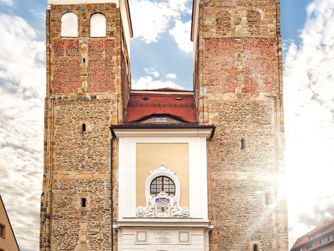
Our tour starts at the Untermarkt. Most of the buildings date from the 16th century. Dominating, of course, is St. Mary's Cathedral, famous among other things for its Romanesque Golden Gate, the tulip pulpit and the Silbermann organs. The high Gothic building of the former Domherrenhof, today's Stadt- & Bergbaumuseum, is also striking. From Untermarkt we head towards Meißner Gasse. Just before it, turn right into Bäckergässchen. At the end of the street you can see the "Haus Dürer" on Pfarrgasse from far away. Between 1902 and 1903, "Haus Dürer" was built on the lower Pfarrgasse and was the city's third citizens' school. In 1928 the school was renamed "Dürer School". During the war years 1941-1945, the house served as a military hospital. In 1963, the building was divided into Oberschule "Albrecht Dürer" I and II. Since 1992 the building has belonged to the Geschwister-Scholl-Gymnasium and is part of the extended building complex consisting of the houses "Haus Albertinum" and "Haus Dürer". Follow Pfarrgasse to Terrassengasse and turn left. At Donatsring, cross the traffic lights and you will see the Freiberg District Hospital in front of you.
In the entrance area of the Freiberg District Hospital, a silver-coloured steel cylinder marks a ventilation shaft through which almost germ-free mine air is taken from the old mine to air-condition the hospital.
After a few steps to the left, turn right into Unterhofstraße, where on the right-hand side, on a block of wall, you will see the Huthaus (a mine building) and the Scheidebank (a building in which the ore was usually roughly hammered out by miners) of the Löffler shaft (first mentioned in 1384, but probably older; in operation until the beginning of the 19th century).
Straight ahead you walk uphill on the Conradsdorfer Weg for about 300 metres in a northerly direction. To the west of this path, in the gardens, there were numerous old shafts on the main Stehenden adit, on which the Löffler shaft also built. This ore gallery, which was several kilometres long and up to seven metres thick (wide), was the most important in the Freiberg mining district and is said to have been discovered for the first time in 1168 by salt-carriers by chance through the discovery of silver-ore-bearing rock in the tracks of the carts. Leave the Conradsdorfer Weg in front of the prominent, tree-covered shaft dump of the Hoffnung Schacht and continue on the Tuttendorfer Weg, which runs parallel to the left and whose route corresponds to the Älteste Dresdner Landstraße. Now on the right of the path, the hiker is accompanied by numerous small and very small slagheaps and backfilled pits on the main gallery. Immediately behind the disused railway line to the former northern heating power station is the black pine-covered shaft dump of the Schöffau shaft on the right, and on the left of the path further dumps on the Glückauf Spatgänge, which cross the main gallery here, have a direction between east/southeast and west/northwest. In the far background on the left is the shaft dump of the former Holy Three Kings Mine (16th century), covered with tall trees, with the grave of the chief miner S. A. W. Freiherr v. Herder (1776-1838, son of the Weimar poet, Goethe's godson).
From here, a detour to Herder's rest is recommended. Behind this name is the neo-Gothic tomb of Freiherr von Herder (1776 - 1838), the head miner of Freiberg. Back on the Tuttendorfer Weg, we stand in front of the Reiche Zeche mine with its winding tower visible from afar. In the late 19th and in the course of the 20th century it was one of the most important mines of the "Himmelfahrt Fundgrube". The slagheap of the "Alte Reiche Zeche" is in the immediate vicinity. Walk between the two slagheaps, then turn left and you will reach the path "Am Hauptstollngang".
On your way down into the valley, cross the disused Freiberg - Halsbrücke railway line, follow the road to the Mulde and keep left. After 100 m you will come across two mouth holes shortly after each other. The one at the back is the mouth hole of the Old Deep Fürstenstolln. The "Alte Fürstenstolln", which was built directly in the main gallery, has been documented since 1384 and is therefore the oldest.
Walk along the Red Ditch created in 1612/13. The yellow to reddish-brown colour of the iron hydroxide precipitates, which gave the artificial ditch its name, is striking. A large slag heap stands out on the right. It is the last witness to the Ludwig shaft, which was created in the middle of the 19th century by the Himmelfahrt discovery pit. A little later we come to the mouth of the Thurmhof auxiliary gallery. Nearby is the well-preserved hat house of the Verträglich Gesellschaft mine. After another 200 m we reach the beginning of the "Roter Graben", which is fed here from the Verträgliche Gesellschaft Stolln with water from the main pits of the "Himmelfahrt Fundgrube".
Leave the Muldental and hike uphill to the ore railway embankment. A few metres above is the mouth of the ore railway tunnel that leads through the "Davidschacht" dump. After about 500 m, you will pass through a garden onto Fuchsmühlenweg. You will see the winding tower of the "Reiche Zeche" again in front of you. At the central cemetery, go left over a small bridge and keep to the right of the "Erzwäche" pond. In front of us we see the buildings of the Abraham shaft. This site shows us a typical large ore mine from the 19th century which still used water power. If you have some time left, you should visit the "Alte Elisabeth" slag heap and enjoy a view of the old town from there.
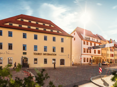
Return to the town via Donatsring (to be on the safe side, please stop at the traffic lights) through Donatstor, past the 15th-century Donatsturm tower to the right into Pfarrgasse with its old houses, mostly from the 16th century, such as house No. 18, belonging to the head miner Martin Planer (1510-1582), or No. 20, belonging to the smelter official Paul Klotz. Opposite this place, the road turns left down the valley into Berggasse, where in 1168 the presumably first discovery of silver ore (plaque on the house Berggasse 1) was made in its lower part on the main gallery crossing here. To the left, the path leads uphill via Aschegasse to the Nikolaikirche (St. Nicholas' Church) on Buttermarkt, whose foundation stone was laid around 1180 and which is now used as a concert and conference hall. Opposite the church is the world's oldest municipal theatre (inaugurated in 1790), affectionately known as the little "Semperoper".
Walk up Enge Gasse and turn left into the pedestrian street. Take another detour to Obermarkt.
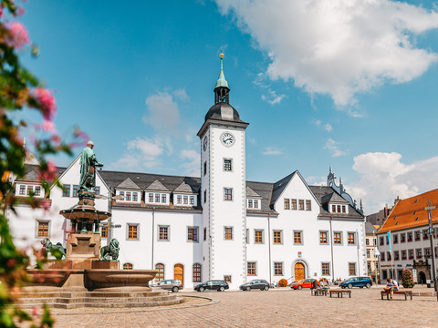
In the middle of the Obermarkt, the founder of the city, Otto the Rich, is enthroned on the lion fountain. The Steigerlied is sung daily at 11.15 am and 4.15 pm from the tower of the town hall. From the bay window of the town hall, the prince robber Knight Kunz von Kauffungen looks down on his place of execution. Today's "Ratskeller" was built in 1545 as the town's department stores'.
From Obermarkt, return to Burgstraße and finish your walk by strolling towards Schlossplatz. Freudenstein Castle houses what is probably the most beautiful and largest mineral exhibition in the world, terra mineralia. At the Silbermann House, the path leads back along Kirchgasse to the starting point, Untermarkt.


